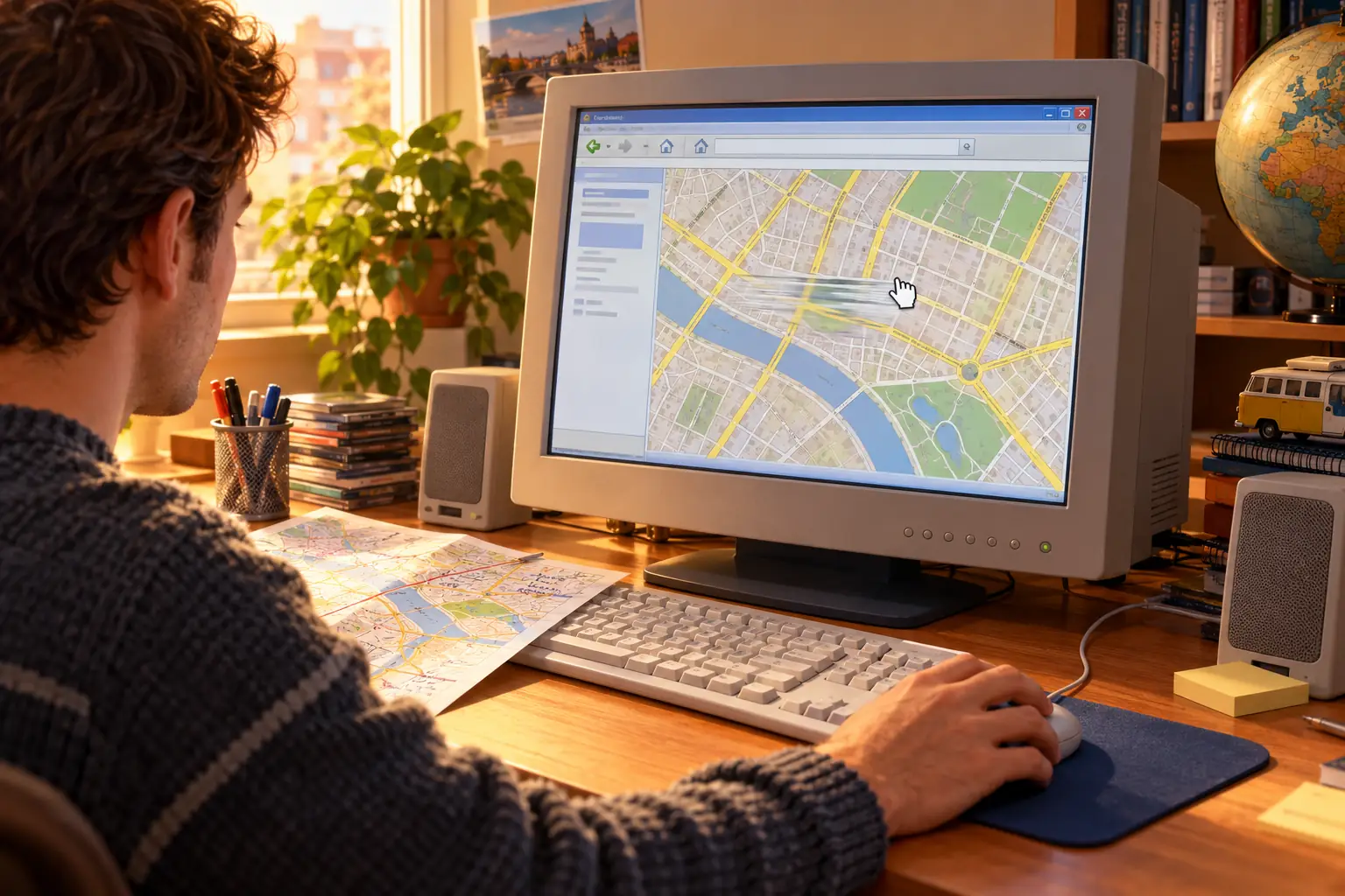
On February 8, 2005, Google suggested an unusual way to use a map: grab it.
That morning, product manager Bret Taylor introduced Google Maps with a simple example. Search for hotels near Los Angeles International Airport. Then click the map and drag it to see what lay next door. There would be no need to ask the website for a whole new page.
Today that sounds as exciting as a working door handle. In 2005, it was worth announcing. Google’s original launch post placed the drag right alongside directions and local business search. The movement was part of the product, not a small decoration.
There were already plenty of maps on the web. That was the point. Google had made a familiar task feel different.
Before the Drag: Ask, Wait, Repeat
For years, sites such as MapQuest and Yahoo Maps had helped people find addresses and plan drives. They were useful. A printed page of directions could ride on the passenger seat, and a street map could save a call to someone who knew the area.
But exploring nearby streets often felt like operating a machine through a letter slot. You searched, the server made a map image, and the browser displayed it. To look farther east, you might click an arrow, then wait while another image or page appeared. Zooming could mean another request. The map was online, but the experience still came in separate pieces.
The old approach was not foolish. It worked across slow connections and simpler browsers. It also drew on years of online mapping work that Google did not invent.
Google’s new page changed the question. Instead of asking the website to show the next piece, you could take hold of the map and pull the neighborhood into view. One motion led to another. If the restaurant you wanted was just beyond the right edge, you did not have to start your search over.
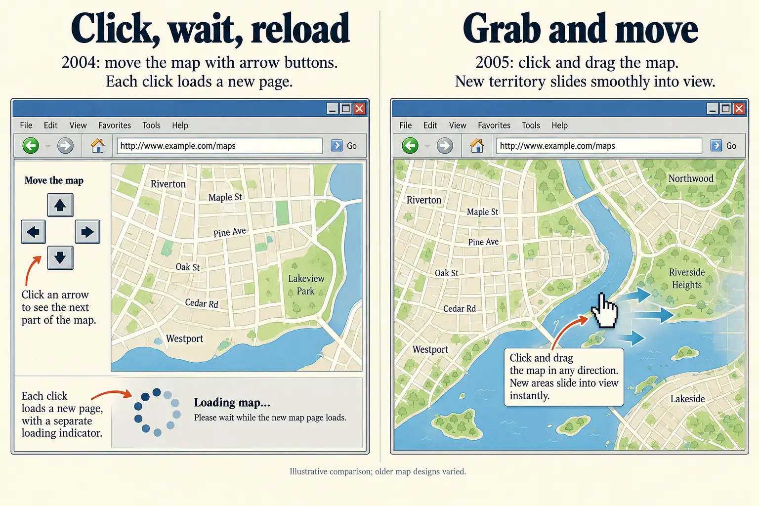
A launch-day Ars Technica report noticed the same thing: the map moved without the familiar click-and-reload routine. The review also pointed out early flaws, including driving-time estimates that could be too hopeful. Nice movement did not make every route correct.
A Map Dream That Began as a Windows Program
One surprising part of the story is that the project behind Google Maps did not begin as a web page.
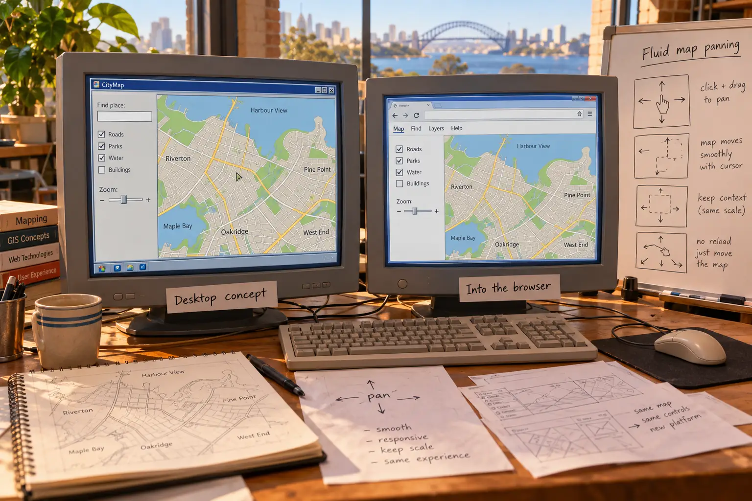
In Sydney, Danish brothers Lars and Jens Rasmussen worked with Noel Gordon and Stephen Ma on a startup called Where 2 Technologies. Their project, Expedition, was a desktop mapping application. That meant a program running on a computer, not a site you opened in your browser.
The small team wanted maps that looked good and responded to the user. Where 2 was acquired by Google in 2004. Inside Google, its work met an existing local-search effort led on the product side by Taylor and other engineers building the web experience.
It was an awkward combination in one helpful way. The Windows program could do things that a browser of the day struggled to do. Instead of accepting the browser’s limits, the team tried to bring the desktop feeling onto the web.
Behind the Scenes: The Windows Program Set a Harder Goal
In a 2023 interview with Shopify’s Tobi Lütke, Taylor remembered the Expedition program and its creators’ deep interest in mapping. His later account says that seeing what the desktop software could do raised the standard for the browser version.
That is a revealing twist. The team was not trying to make an ordinary web map a little faster. It was trying to give the web something closer to the feel of an installed application.
Stephen Ma gave his own account of the Sydney group’s early work in a 2025 anniversary interview. His telling is also a reminder that a famous product seldom comes from one person. The Rasmussen brothers were central, but the original startup had four founders, and the finished Google service needed a wider team.
The Trick: Move Now, Load the Next Piece Quietly
What made dragging possible? Not one magic command. It took a handful of web techniques used together with care.
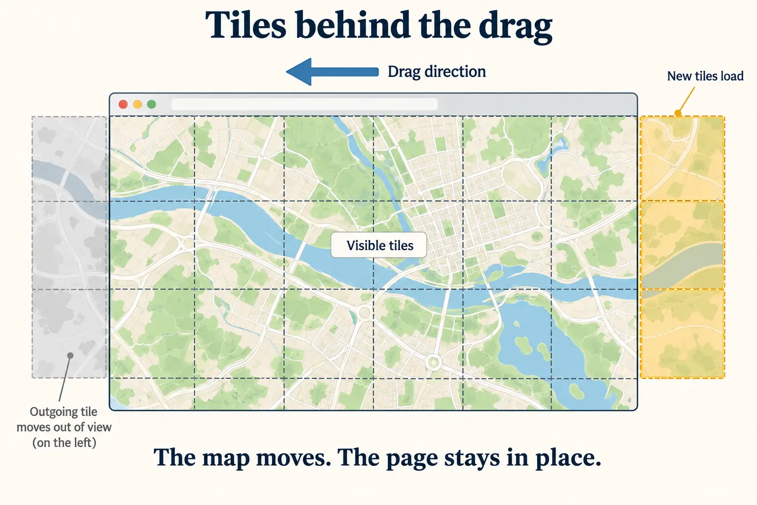
Think of a big map cut into many small square pictures. Your browser shows only the pieces needed for the part of town on screen. When you drag, the pictures already there can move at once. Meanwhile, the browser asks the server for the new pieces coming in at the edge.
The whole page does not have to disappear and come back. A road or label may take a moment to appear on a slower connection, but you can keep looking around.
JavaScript, the language used to make web pages respond to actions, handled much of the movement. Background web requests brought in new information without sending the user to a fresh page. This approach became widely known as Ajax. Google Maps was one of its best-known early demonstrations, but neither the underlying tools nor interactive web pages began with Google Maps.
There was a great deal of work hiding beneath that simple motion. Taylor later recalled browser crashes, slow links, and problems with how many images could load together. In a later interview about building Maps, he described using many server subdomains to work around limits on simultaneous image downloads in older browsers.
In plain English, a browser might agree to fetch only a small number of pictures at once from one address. The team gave it more addresses to work with. The map felt like a sheet sliding under glass because engineers were busy arranging the pieces behind the glass.
This is also why the phrase “no reload” needs care. New map images still traveled over the internet. What disappeared was the stop-start ritual of replacing the whole page every time the user looked to the side.
What a Person Could Really Do in 2005
At launch, Google Maps was a free-to-use website for someone who already had a computer, web browser, and internet connection. It could search for addresses and businesses, show directions, and let visitors move or zoom the map. Taylor’s first post even mentioned arrow-key movement and the plus and minus keys for zooming.
One of his examples was looking up hotels near LAX. It sounds modest, but it showed a useful change. A visitor could look for a hotel, see where it stood, then slide the map toward nearby roads without losing the context.
It was not the globe-spanning mobile guide we know today. The first service covered the United States, Puerto Rico, and parts of Canada. Users of Internet Explorer and Mozilla-based browsers had the clearest initial support. Safari and Opera were left behind at launch, though Google announced support for them on February 25.
And the turn-by-turn directions in that first desktop site were written steps. They were not the live, voice-guided phone navigation that Google would introduce years later. People could still print directions, get in a car, and argue about which exit the paper meant.
Fun Fact: Google Was Not the Map King Overnight
A 2005 Hitwise snapshot of U.S. travel/maps website visits for the week ending July 23 gave Yahoo Maps about 41%, MapQuest about 33%, and Google Maps about 9%. Those figures describe that measured week’s site traffic, not every map user everywhere. They show a crowded market, not a one-day takeover.
The competition mattered. MapQuest was not suddenly useless because another site could drag. Yahoo Maps still had a large audience. Mapping needed good data, directions people trusted, and places worth searching for. Fancy movement could win a visitor’s curiosity; getting them to the right street earned another visit.
The Satellite Button Arrived After the Launch
A common memory folds every famous Google Maps feature into that first day. The record is more interesting when we keep the dates apart.
Google bought Keyhole, a company known for a way to explore the Earth using imagery, in 2004. On April 4, 2005, Google’s John Hanke announced satellite views in Google Maps and Google Local. People could now check a street map, choose a view from above, and drag that image too.
It opened another kind of browsing. Someone could look at the roof of a possible new home, the shape of a beach, or the roads around a strange interchange. They could also simply wander from one image to the next for the pleasure of seeing a familiar place from the sky.
This did not mean every location had equally sharp imagery. Nor did it mean the photographs were live pictures of what was happening outside. A satellite view was another layer of stored data, with its own dates and limits.
Google Earth was a separate product. It arrived in June 2005 as a desktop program for exploring a three-dimensional globe. That is another story. For Google Maps, the striking change was that the ordinary map and the view from above could both live inside an everyday browser.
The Map Escaped Its Own Website
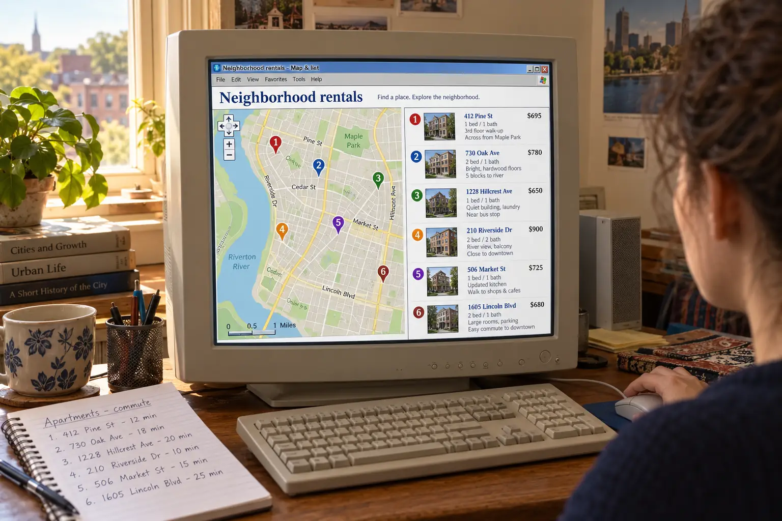
Early in 2005, programmer Paul Rademacher faced a different map problem: finding a place to live. Craigslist had listings. Google had the map. He wanted the listings to make sense together.
His answer was HousingMaps.com, which placed housing listings onto a draggable Google map. The result let apartment hunters think in neighborhoods instead of reading one address after another. It was not an official Google feature. Rademacher connected the services himself before Google had offered a public Maps programming interface.
The project is a fine example of how a small design choice can grow beyond its maker’s plan. You could drag a map, yes. But now other people could put their own useful information on that map.
Google noticed. On June 29, 2005, Taylor announced the Google Maps API. An API is a set of tools and rules that lets one program use part of another service. In this case, it allowed web developers to place interactive Google maps on their own sites.
In Google’s 2007 account, HousingMaps was an early surprise that helped encourage the official API. Another early project, ChicagoCrime.org, used location to help readers explore public crime reports. These sites belonged to the web’s new wave of mashups, where people combined data and tools from more than one place.
The most important part was not the clever name. A map was becoming a shared surface for questions that were not just about driving: Which apartments are near work? Where did something happen? What is close to this school?
The Longer Road Was Not Just About Dragging
The first few years brought features that people now tend to remember as one big bundle. Google added a Portland, Oregon, public-transit trip-planning experiment in December 2005. Street View, with pictures taken along roads, launched in five U.S. cities in May 2007. Voice-guided Google Maps Navigation for Android 2.0 followed in October 2009.
These additions changed what a map was for. A desktop visitor who once needed a route could become a phone user checking traffic, a traveler looking at a street before arriving, or a local business hoping to be found.
That growth also made maps more complicated. Driving suggestions depend on map data, and map data can be wrong or out of date. Business listings change. Coverage varies by country. Connected maps also raise real questions about the location information people share and the power of a company that runs a widely used map platform.
None of that takes away from the joy of the 2005 page. It puts the joy in perspective. Google did not invent the map, the online directions page, or the code used for lively web applications. Where 2’s desktop idea, Google’s local-search work, the people who built the browser version, mapping-data suppliers, and early outside developers all belong in the history.
Legend vs. the Record: Did Google Invent Online Maps?
The legend: Before Google Maps, you could not look up a map on the internet.
The record: Online mapping and directions services existed well before February 2005. What made Google’s launch stand out was the way it brought smooth, draggable exploration into a mainstream browser service, then joined that experience with search, imagery, and outside applications.
There is one small moment worth keeping. On an older website, the edge of the map was a stopping point. You reached it, chose a direction, and asked for another picture. On Google Maps in 2005, the edge became something you could pull past.
That did not solve every problem of getting around. But for a moment, using a web page felt less like filling out a form and more like touching the thing you wanted to explore.
Sources and Further Reading
- Google’s February 8, 2005 launch note — Bret Taylor explains draggable maps, keyboard movement, search, and directions.
- Ars Technica’s launch-day report — a contemporary account of the new interface, early coverage, and browser limits.
- Bret Taylor’s later creator interview — the Where 2 desktop origins and the demanding browser work, presented as his recollection.
- Stephen Ma’s anniversary account — the Sydney startup and the people behind its early program.
- Google’s February 25 browser update — Safari and Opera support soon after launch.
- Google’s April 4 satellite-view announcement — the dated addition of Keyhole imagery to Maps.
- June 29 Google Maps API announcement and Google’s later mashup account — how outside websites began to build on Maps.
- 2005 Hitwise traffic report summary — a period snapshot of Yahoo Maps, MapQuest, and Google Maps visits.
- Google’s 15-year Maps timeline — dated landmarks including public transit, Street View, and later navigation.